 Lamanai Mayan Archaeological Site. The Lamanai site is one of the oldest continuously occupied Maya sites in Belize, from about 1500 BC when maize was being grown at the site, to 1680 AD.
The name "Lamanai" means submerged insect.
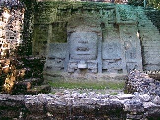
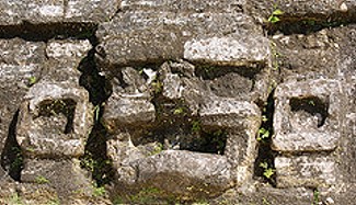
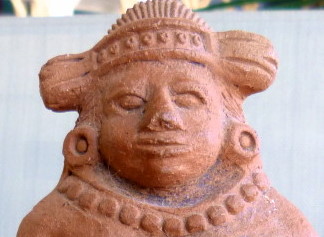
However, archaeologists realized in 1978 that Franciscan monks had corrupted the name from "Lam'an/ayin" to "Lamanai," and that adding the correct suffix of "ayin" changed the meaning of the name to submerged crocodile, a conclusion supported by the large number of crocodile representations found at Lamanai, including figurines, pottery decorations and the headdress of a 13 foot limestone mask found on a 6th century temple platform.
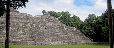
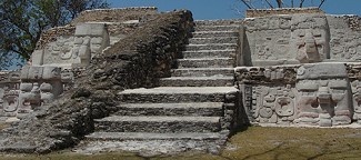
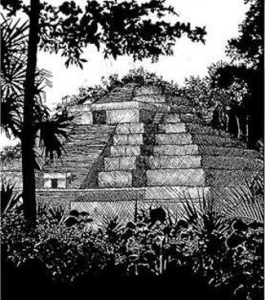
Lamanai, located on 950 ares (the site's core is about a 12 square miles), is one of the largest Maya ceremonial sites in Belize, including more than 100 minor structures, a ball court and about 12 major buildings, most notably the Temple of the Mask, thought to be an Olmec God or Kinich Ahau, the Maya Sun God, the Temple of the Jaguar Masks and the High Temple (so-called because of its height).
Lamanai's lay-out was quite different from most other Maya sites in Belize that were generally organized in plazas around a ceremonal structure. However, at Lamanai, most ceremonial buildings were built along the west bank of the New River and the New River Lagoon, with residential structures to the north, west and south.
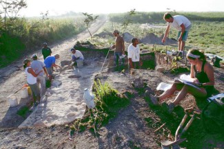
Only about 5% of the site has been investigated and much remains buried or covered by jungle and bush. However, archaeologists do know that structures were built on top of other structures, with the older structures frequently at least partially razed, sometimes leaving masks and other ornamental features from the older buildings in odd places in the new buildings, such as in stairwells.
In addition to Mayan buildings and artifacts, the Lamanai site also includes the remains of a 19th century sugar mill, a brick-lined reservoir and the charred remains of two 16th century Catholic churches. The church remains are charred because the Maya burned each of them down after the Spanish built the churches in an attempt to convert the Maya inhabitants of Lamanai to Catholicism. The first church building particularly incensed the Maya -- the Spanish built the church on the foundations of a Mayan temple that they demolished to make way for the new church.
Lamanai continued to flourish in the Post Classic Period primarily because of its trade of metals, particularly copper objects, thought to have been produced on-site at Lamanai beginning by approximately 1150 AD. More copper artifacts have been found at Lamanai than at any other Mayan site, and the artifacts have included bells, rings, tweezers, various clothing ornaments, pins, axes, chisels, needles, and fish hooks.
Access to the Lamanai ruins is by boat up the New River from Orange Walk. Crooked Tree Wildlife Sanctuary is located 8 miles west of the Lamanai Archological reserve.
Latitude: 17°45'9.36"N/Longitude: 88°39'16.20"W
 Caracol Mayan Archaeological Site. Caracol's ancient Mayan name was Uxwitza, or "Three Water Hill." Its Early Classic name was Ux Witz Ajaw, or "Three Hills Lord."
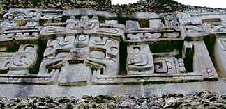
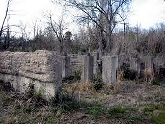
 Nim Li Punit